The Pamir Mountains and the Pamir Highway in Tajikistan should be on your bucket list. Honestly. This area is beyond words to describe and beyond pictures to show. To get even close to this, in this blog you’ll find more information about the Pamir Mountains in Tajikistan and read everything about our 8-day tour, the ideal itinerary, costs, nice guesthouses and all kinds of other things you need to know to do this Pamir Highway trip as well and prepared as possible. Self, or organized. We did this route during our 3-week trip through Tajikistan. Enjoy!
Where are the Pamir Mountains and the Pamir Highway located in Tajikistan?
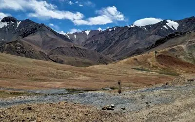
The Pamir is a mountain range in Central Asia. It lies mostly in the south and east of Tajikistan, but also in northeastern Afghanistan, northern Pakistan and a small part in western China. So quite a large area. We visited the Pamir Mountains and the Pamir Highway from Tajikistan, which is what most travelers do, because then you see most of it (and apparently the most beautiful part!). Much of the Pamir Highway from Tajikistan goes through the Wahkan Valley. This valley is on the border of Tajikistan and Afghanistan and is the most beautiful valley in all of Tajikistan if you ask me.
How do you get to the Pamir Highway from Dushanbe?
First of all, make sure you stay in an international hostel where you meet other travelers. We stayed at the Green House Hostel. Of course, you can also go to the Pamir Highway alone or with your travel partner, but then the cost is significantly higher. We split the cost of a driver + jeep with another couple. Below you can read what we lost in terms of cost on the Pamir Highway tour.
My tip: do not drive the Pamir Highway yourself and always arrange a driver. Not only because of the terribly bad roads (which the Chinese are now partly constructing), but also because you get several military checks as well as police signals. Not a problem for us, because we had a local driver, but we also met travelers who had to pay more than $300 in the first 4 days for unnecessary extras at such stops. In addition, really choose for your own safety, avoid unnecessary loss of time because you are not used to drive on such trails, arrange a good driver who can also tell you more about the area and take you to the most beautiful places.
How much does it cost to go to the Pamir Highway (Tajikistan)?
Of course you can make it as crazy and cheap as you want, but what we did is pretty ‘normal’. Of course you can bike there, hitchhike or drive yourself, but we opted for a jeep + driver. This cost us $1550 for 8 days. For the whole car. On top of that came the costs for the guesthouses. These were between $20-$25 per person per guesthouse, including accommodation, breakfast and dinner. It can be cheaper, but then you also get less good guesthouses that are less clean (our driver told us). For us, then, the choice is easy.
We shared the car with a very nice German couple. For 8 days we paid $775 (for 2) + $300 (guesthouses). So per person $537.50 per person for 8 days, not including tip for the driver. The tip for our driver was $100.
We did shopping in advance at the supermarket in Dushanbe for extra snacks for the road and wine. For that we paid about €40 combined. So a great price for a fantastic 8-day Pamir Highway trip. Along the way we had picnic lunch or stopped somewhere along the way. You can also find these tips in this article.

Important information for the Pamir Mountains and the Pamir Highway
- You need a Pamir Mountain permit, also known as the GBAO permit. This will cost you between 50 and 100 somoni. The normal price is 50, but then you have to wait a few days for the permit. It wouldn’t be Tajikistan if it also varies who you meet whether you have to pay 70 or 100 (if you wait). We had to pay 70 and got our permit right away.
- You need your passport. We were checked several times in one day, so put your permit with your passport and make sure you can get to it at any time (so not in the back of a compartment in your big backpack in the back of the jeep).
- Ask for an English driver. We were assigned to a non-English speaking driver along the way (because of problems with our car, (sh)it happens), who couldn’t even explain where we were going. No fun when you are stuck for 8 days (or even more) with someone with whom you literally cannot exchange a word. My tip: ask if the driver can come to your hostel to go over the tour. Our driver offered this himself and we immediately had a good feeling. Want the details of our driver? Then leave a comment below this below this article and I can give his number.
- Make sure you have enough cash along the way. We paid for the tour and guesthouses (including breakfast and dinner) right away, but of course you’ll want to buy lunch, extra water or snacks, or possibly souvenirs along the way.
- Make sure you have altitude sickness tablets, paracetamol, diarrhea inhibitors. By day 4, everyone was battered. Some because of altitude sickness (because of a hike above 4800 meters) and some because of stomach/intestinal problems (a.k.a. diarrhea).
- Buy plenty of snacks. The food is fine, but it is certainly not varied and for vegetarians like me, the menu is quite monotonous.
The ideal route through the Pamir Mountains and along the Pamir Highway
The nice thing about having a driver from the region is that he knows the most beautiful places (although the way there is just one straight road) with the nicest and finest guesthouses.So all we had to do was sit, look around and enjoy.For us, the ideal itinerary through the Pamir Mountains in Tajikistan consisted of 8 days.Below is a comprehensive travelogue of our Pamir Highway trip.Rather read the summary with all the stopovers, guesthouses, hikes and other tips?You can find those at the bottom of this article.
Day 1: from Dushanbe to Qul’ai Chump
Day 1 immediately started fantastic as soon as we left Dushanbe, Tajikistan, (with no pain in our hearts, we didn’t like Dushanbe). From Dushanbe to Qul’ai Chumb is about a 350 kilometer drive.We left around 10:30 in the morning, went to 2 supermarkets, made a lunch stop along the way and arrived in Qul’ai Chumb via Kulob around 18:45.The landscapes varied from dry hills to high rocks and from deep valleys to swirling rivers.
Along the way, we made another stop at the viewpoint of “the Norak Reservoir.The most bizarre thing about this day, though, was that we drove continuously next to Afghanistan.Only a river separated us from war zone.Although marked as a safe area, the Taliban just reigns on the other side.We saw white flags everywhere, placed by the Taliban, that immediately indicated who rules. Bizarre.Really bizarre.
It was incredibly beautiful, but at the same time my heart cried, because I can’t swallow the fact that every day Afghans see free people across the river.At such moments I realize even more than I always do, that we should consider ourselves very lucky to have been born in the Netherlands. I became silent.
After a fantastic first day, we arrived at a very nice guesthouse.Our driver told us that there was a nicer guesthouse just outside Qul’ai Chumb, by the river, so he took us there.What a TOP day.
Pin this highlight day 1 in maps.me:Viewpoint of ’the Norak ReservoirLeft photo: on the middle of the bridge you can see a white flag. Right photo: the turnoff to Afghanistan.
Day 2: from Qul’ai Chumb to Khorogh
Our alarm clock was at 03:50 because we had to leave at 04:00.The Chinese in this area are building a new road and between certain times parts of the road are closed, due to work.We heard they started at 07:00, so we had to make sure we passed that section before then. So always check with a local about the “opening hours” of the road.Although it was a rainy day, it was obviously enjoyable as the views remained visible and beautiful. Hiking was unfortunately not in the cards today, so we did that on the way back, on day 7.
Day 3: from Khorogh to Zong
Day 3 was a gem. It was sunny and clear so the Afghan/Tajik Wahkan valley looked more beautiful than ever. Peering out for hours from the jeep is fantastic with such views. Along the way we stopped at several highlights, my favorite of which was the hot spring. Men and women go in here separately and naked. We got talking to a Tajik family (women) and ended up in the hot spring with them, chatting and chatting. It was bloody hot, but lovely.
Pin these highlights from Day 3 in maps.me:
- Yamchun Fort (or Zamr-i-Atash-Parast or Kafir-Qala): one of the oldest remains in the Wahkan Valley
- Bibi Fatima: a natural hot spring in the caves
- Fortress Abrashim Qala
Day 4: From Zong to Alichur including hike to Hausibek’s viewpoint (4,800 meters)
After a turbulent night (and later turned out to be a turbulent day as well), we left around 8:00 am in the direction of Alichur. A route of 237 kilometers, with a fantastic hike with panoramic views along the way.
The first part of the day went well. We had been given bread and eggs from the guesthouse to eat at the top of the hike along the way and were treated to incredible views again in the morning. Once we arrived at the starting point for the hike (between Karadara lake and Kargush lake) you have two choices: the steep trail or panorama ridge trail. At the time, we didn’t know the panorama ridge trail existed haha, so chose the steep trail. The name didn’t lie.
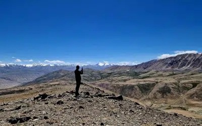
Although it was only 500 meters of climbing, it was pretty intense as we climbed to 4,800 meters. Once we reached the top (the rest had already dropped out) we had quite a headache because of the altitude, which didn’t go away and even got worse. By the way, the view was fantastic as the Pamir Mountains stretched out in front of us and we literally had a 360 degree view.
The route in the car to Alichur was quite intense, because of incredible potholes in the road, even though by now we had already braved the Pamir Highway. Highway I wouldn’t really call it….
In Alichur we were fortunately allowed to sleep in a fantastic yurt and spent the first few hours in bed to recover. When the headache subsided after paracetamol and altitude sickness medication, we became a little more ourselves again. We skipped dinner and got under the thick blankets of the yurt. On to day 5.
Pin these highlights from day 4 in maps.me:
- Hausibek’s viewpoint -> Panorama ridge trail, near Karadara lake and Kargush lake)
Day 5: from Alichur to Karakul
Today went a little differently than planned. Since yesterday our car had already broken down and this was not fixed by 09:00 this morning, we (Rick and I and the German couple we are traveling with) had to join another group in the jeep. All the backpacks on top, we cramped in the jeep. The driver of this jeep literally didn’t speak a word of English so basically we barely had a clue what our plan was.
Although everything went haywire this day, the views were fantastically beautiful. Perhaps the most beautiful of the entire 8-day trip. We drove over a 4,600-meter-high Abbatial Pass toward Lake Karakul and enjoyed incredibly beautiful views. It was enjoyable to the max.
We slept in a guesthouse in Karakul, which we wouldn’t necessarily recommend. At least, not the “village. There are no ‘restaurants’ and there is 1 little store, where they don’t even sell bread or water. So we ate dry noodles, because in our guesthouse the owners were washing their clothes in the river. In the end we luckily got some food.
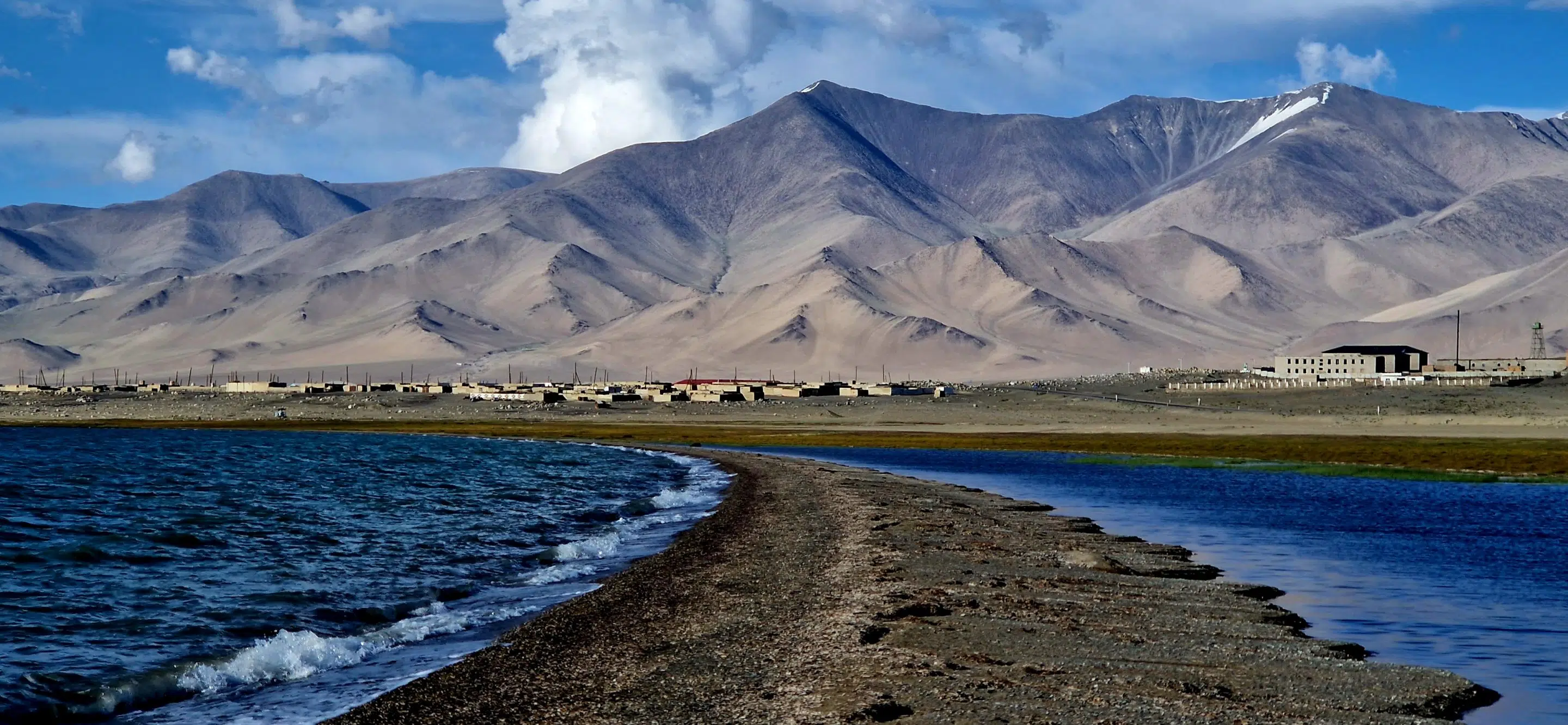
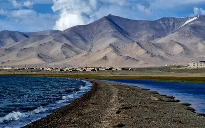
Near Karakul village you will also find Karakul Lake, which with its deep blue color stands out against the snow-capped mountain peaks. What a pearl and what peace.
Want to hike at Karakul Lake and have time to get back before dark? Then make your way to South Aral and get a fantastic view of the lake. Are you arriving at Karakul later? Then a simple walk along the lake is no punishment either.
Pin these highlights from day 5 in maps.me:
- Abbatial pass
- Karakul lake
Day 6: From Karakol to Khorog
Over exactly the same 4,600-meter Abbatial Pass we drove back towards Alichur and finally to lake Bulukul. Again fantastically beautiful. Taking a hike along the way in that area? You have 2 hike options: directly to the lake via the ‘road’ (2 km out and 2 km back from the village) or via the road up to the top (6 km out and 6 km back).
Pin this highlight of day 6 in maps.me:
- Lake Bulukul
Day 7: From Khorog to Qul’ai Chump
New attempt at the hike today, which we actually wanted to do on day 2. Although the hike wasn’t 100% on the route and we took a small detour, it was he-ly worth it. We drove to the Jizev brigde via the Bartang River (amazing valley!) where the hike started. Difficult? Certainly not. Fantastically beautiful? 100%. So if you’re doing the Pamir Highway from Tajikistan, really save this hike. It’s about 6.4 km there and 6.4 km back. Impossible to get lost because there is only 1 path.
That was the positive of today. Then we had to drive another 6 hours to Qul’ai Chump, on the worst road ever. Add to that about 3 traffic jams in the mountains, incredible potholes in the road, a precipice tens of meters deep by the river, while we drove in pitch darkness and had to go through countless clouds of dust, so we couldn’t see anything, and then you have approximately an idea of how the drive back went. At 11 p.m. we arrived at our guesthouse fairly exhausted. Linea recta to bed.
Pin these highlights of day 7 in maps.me:
- Jizev bridge
- Jizevdara (the lake where you end up after the hike)
Day 8: from Qul’ai Chump to Dushanbe
I can be brief: it was in one straight way back. Although I was a little reluctant because it was a typical last day, I enjoyed every minute of it. The views are simply extremely beautiful here in Tajikistan.
Summary of the Pamir Highway in Tajikistan
Itinerary Pamir Mountains & Pamir Highway from Tajikistan:
Dushanbe – Qul’ai Chumb – Khorogh – Zong – Alichur – Karakul – Khorogh – Qul’ai Chump – Dushanbe
Tips for guesthouses and lunch spots in Tajikistan during the Pamir Highway tour
Guesthouses:
- Day 1 and day 7: Guesthouse Zing, just outside Qul’ai Chump
- Day 2 and day 6: Guesthouse of the brother of our driver
- Day 3: Guesthouse Nidokhon (also a supermarket) in Zong
- Day 4: Guesthouse near Marco Polo hostel, but in a yurt, in Alichur
- Day 5: Guesthouse Erkin, the first guesthouse you find in Karakol
Hiking during the Pamir Mountains tour
- Hike to Panorama ridge
- Hike at Karakul
- Jizev bridge hike
Prefer organized hiking?
Is organizing everything yourself in Tajikistan too much hassle for you? I understand. It is not Europe and travel is just a bit different than on our own continent or in South America for example. Fortunately, there are plenty of options to book your trip in advance.


0 reacties